
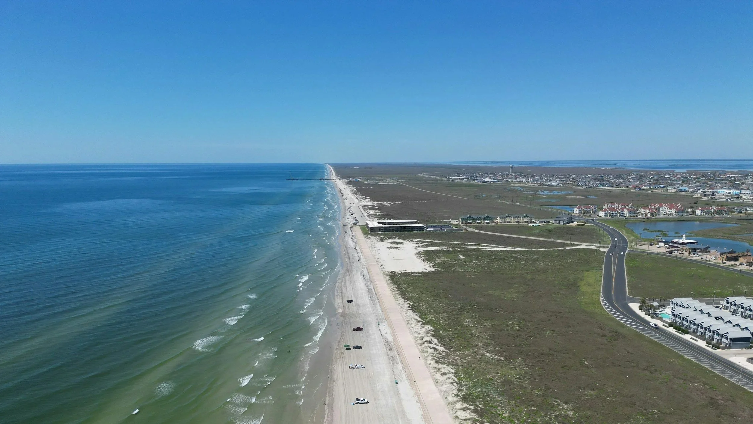
GEOSPATIAL MODELING OF THE GULF COAST
The Conrad Blucher Institute's Regional Geospatial Modeling Program was conducted in partnership with the University of Southern Mississippi, the Alabama Department of Transportation, the Florida Department of Transportation, the LSU Center for GeoInformatics, and the University of Florida. The program focused on enhancing the National Spatial Reference System along the northern Gulf Coast, a region providing significant economic return through trade and energy, and among the most exposed to inundation from tropical storm surge. The region's unique low-lying coastal topography faces increasing inundation risk from long-term climate change and subsidence. The program concluded in 2023 with the close of the NGS Regional Geospatial Modeling Grant.
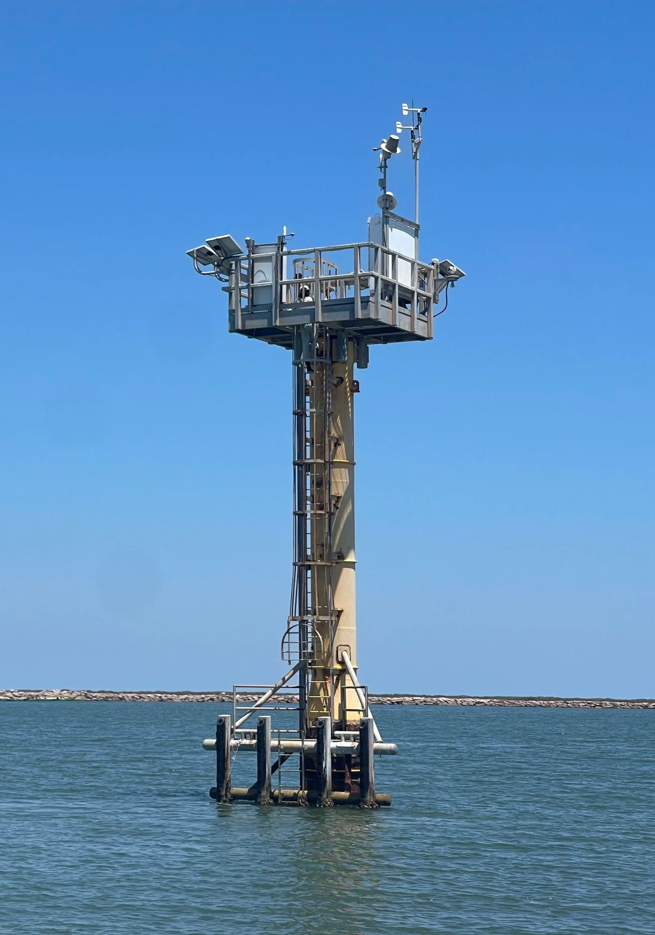
Tide Gauges on the Matagorda Bay Entrance Channel’s Single Pile Instrumentation Platform (SPIP)
program goals
The program's goals included:
Extending GNSS multi-station height modernization network observations along the northern Gulf Coast from Texas to Florida, filling network gaps in Louisiana, Mississippi, and Alabama using tide gauge benchmarks, coastal CORS, and NGS vertical control benchmarks
Providing accurate geodetic 3D positions in a national spatial reference frame connected to the global terrestrial reference frame, supporting long-term monitoring of relative sea-level change
Expanding CORS stations on tide gauges to support accurate 3D positioning and subsidence monitoring
Conducting a comprehensive study of vertical motion from archived CORS data across Gulf states, producing a detailed map of vertical land motion
Establishing a baseline of high-accuracy elevation data for monitoring marsh surface elevation trends at sites from Texas to Florida, using Surface Elevation Table data, terrestrial laser scanning, LiDAR, and small unmanned aerial systems
Supporting education and technology transfer through regional workshops coordinated with NOAA, NGS, and other National Height Modernization Program (NHMP) partners, offering professional development and continuing education credit
Serving as a liaison, through TSRC investigators, between geodetic resource consumers and NGS in support of NHMP activities throughout the region
program accomplishments
Over its ten-year duration, the program produced substantial results beyond its original goals:
Infrastructure — Installation of two new GNSS/CORS stations in Texas and one in Louisiana, expanding continuous monitoring coverage along the Gulf Coast. In partnership with TxDOT's Corpus Christi division, the program also Bluebooked 25 marks, including 12 TxDOT Regional Reference Marks submitted for inclusion in the NGS CORS Database.
Field Surveys — UAS, terrestrial LiDAR, and mobile LiDAR surveys conducted at coastal sites including North Padre Island and Port Aransas, supporting beach and benchmark monitoring for local governments and coastal managers.
Gravity Measurements — Gravity surveys supporting geoid modeling and vertical datum research.
Data Dissemination — Program data and survey products were made publicly available through Gulf3D.org, a data repository developed under the program.
Publication — Program research was published in the International Journal of Applied Earth Observation and Geoinformation: Qiao, X., Chu, T., Tissot, P., Ali, I., and Ahmed, M. (2023), Vertical land motion monitored with satellite radar altimetry and tide gauge along the Texas coastline, USA, between 1993 and 2020.
Outreach — Program findings were presented at the Texas Society of Professional Surveyors Symposium, along with national conferences including AGU, ASPRS, and ASCE.
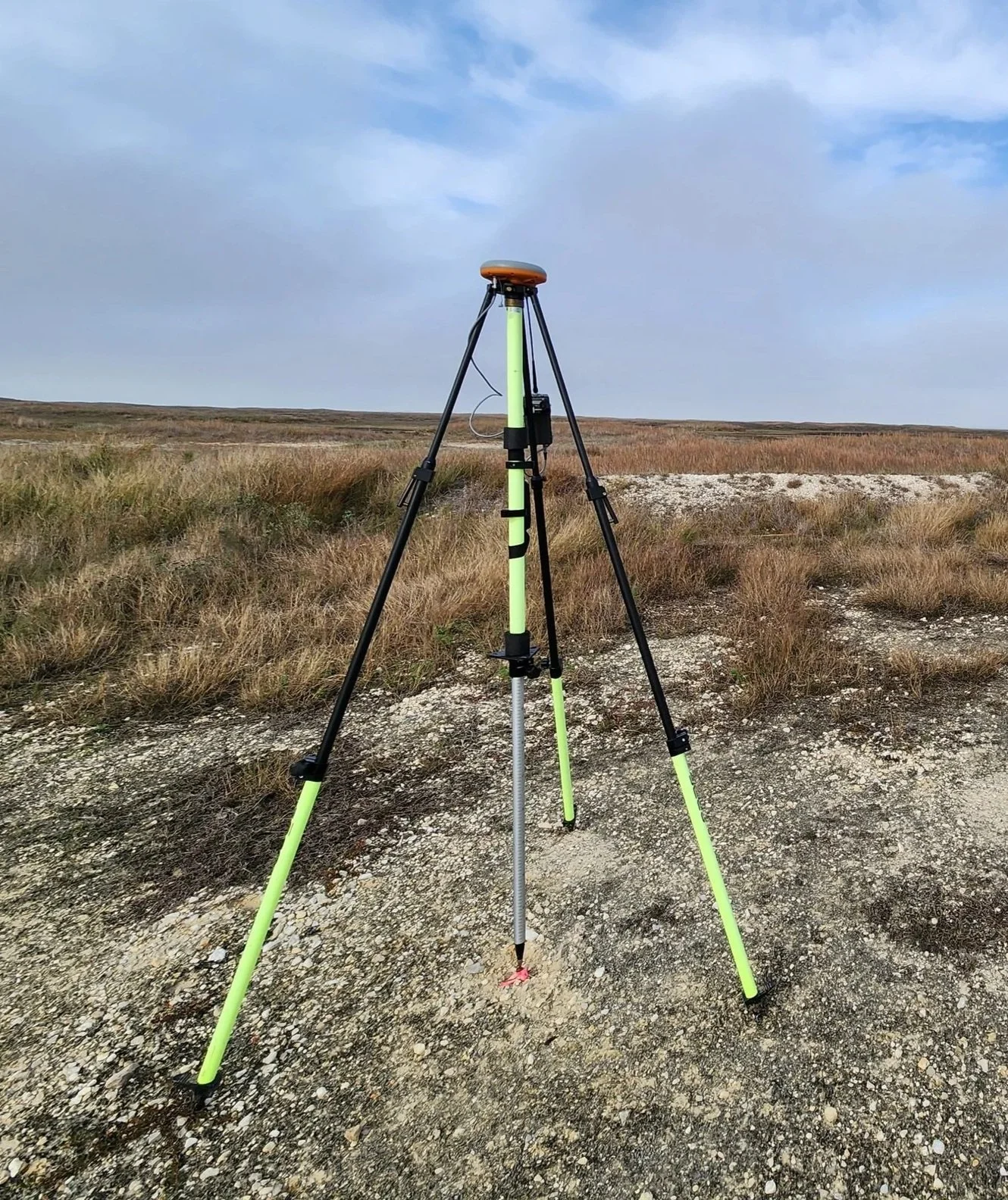
Static observations on Texas Coast Tidal Flats
related studies
lidar sea level impact on coastal marshes
Sea level rise affects coastal marshes, which serve as habitat for commercially important species like blue crabs and sportfish, and provide nutrient filtration and erosion buffering. This study used LiDAR to observe marsh elevation change, with surveys conducted in Corpus Christi and other Gulf sites in Mississippi and Florida.
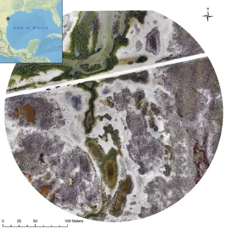
The image above shows a LiDAR-derived aerial view of a coastal marsh survey site along the Texas coast.
GULF COAST SUBSIDENCE
This study identified areas of subsidence along the Gulf coast using data from Continuously Operating Reference Stations (CORS), which submit daily GPS position data to a central repository for standardization and trend analysis. This continuous GPS (cGPS) data was processed using GipsyX, provided by JPL at the California Institute of Technology. Research under this program studied the impact of ocean loading on GPS by comparing cGPS and tide gauge time series, focusing on Rockport, Texas, due to its nearby location and similarly stable foundations for both instruments, work that involved moving cGPS processing in-house with a GipsyX license and customized data controls.
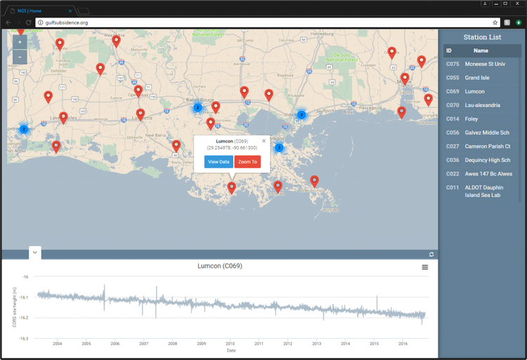
A web-based tool built to automate processing and provide access to time-series subsidence data for the Gulf Coast region.
SPATIAL VARIABILITY OF SUBSIDENCE AND RELATIVE SEA LEVEL RISE
Along the Gulf Coast's northwestern shores, subsidence often exceeds the rate of sea level rise. The spatial variability of the resulting relative sea level rise (RSLR) was not well understood or measured, despite its importance for planning coastal structures, guiding habitat migration, and anticipating future coastal flooding. This study developed a more precise technique using a high density of tide gauges to measure that spatial variability, comparing tide gauge signal data with continuous GPS (cGPS) data from collocated Continuously Operating Reference Stations (CORS).
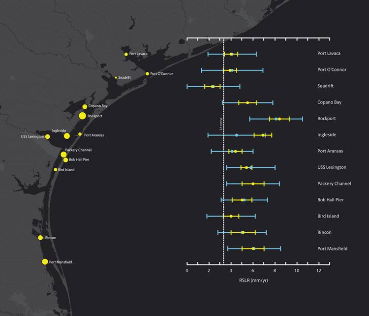
Measured relative sea level rise (RSLR) rates at coastal monitoring sites from Port Lavaca to Port Mansfield, Texas.